The bridge formerly known as Danger is open and waiting for you to explore. This is from Lincoln Parks and Recreation’s Facebook page:
“The upgrades make Wilderness Park more welcoming and accessible for everyone and ensure that all visitors can enjoy a safer, more inclusive experience as they explore the beauty of the park.”
“We are happy to announce the Rock Island Trail Bridge over Salt Creek in Wilderness Park is now open! The bridge had been under renovations since May 2024 and now connects the Rock Island Trail at Densmore Park to Wilderness Park. Improvements to the former railroad bridge located between trail markers 50 and 51 in the center of Wilderness Park include new concrete decking and railings. The $621,000 project was funded by a Land and Water Conservation Fund grant, and from partners including the Great Plains Trail Network, the Lower Platte South Natural Resources District, and the Run for the Bridges event. Thanks to all of the patient park visitors and trail users.”
As to the name we know it by, there used to be a yellow caution sign at the east end of the bridge, that I should have gotten a picture of, that actually said “Danger Bridge”. I wonder where it is now?
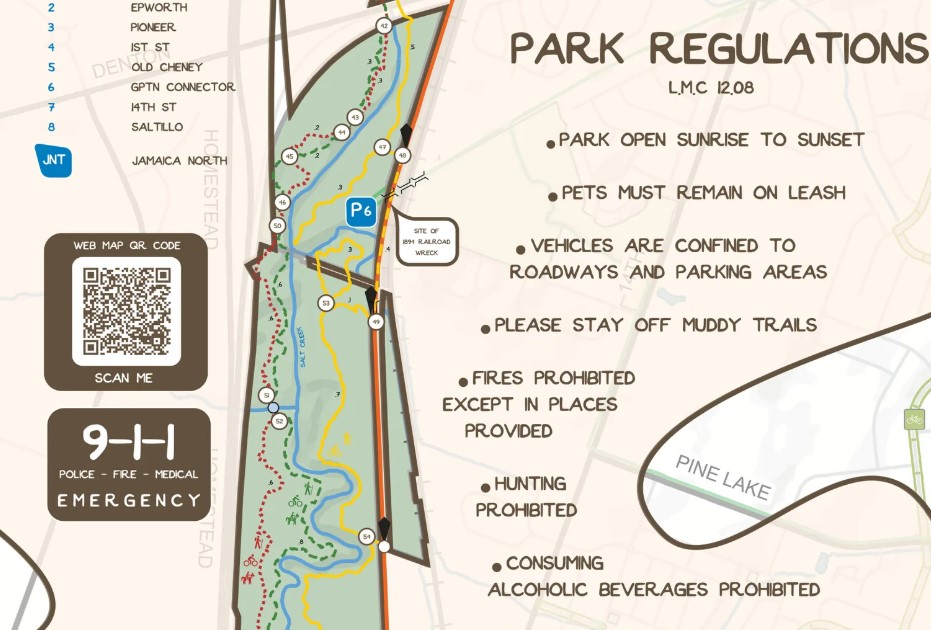
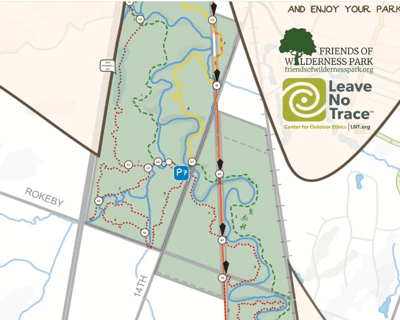
The bridge and the much improved stream crossing on the west side of the park, about a quarter-mile south of the west end of the bridge, make it much easier to explore the west side of the park. If you haven’t, I encourage you to check it out. That and the new bridge in the corner of the park near Rokeby and hwy 77 make it easier to do a complete loop on the west side. Also, check out Friends of Wilderness Park’s website to find a map, more about the history and beginnings of the park under the “Learn” tab, and about ways you can get involved and help the park.
The park is great to visit all year around (and it’s a good place to get out of the wind.) That is except when it’s muddy. Please steer clear of the dirt trails at these times, and even the limestone of the Jamaica North trail, if you find your tires sink and leave tracks. The exception may be if you ride a fat bike. If soft but not muddy, the 3 1/2″ or 4″ tires can help flatten the ruts out made by skinnier tires.
For information about monthly walks, cedar cuts, and forestry maintenance trail closures, consult FWP’s Facebook page.
“The Parks and Recreation Department has announced that two Wilderness Park trails will temporarily close beginning Wednesday, January 29, for forestry maintenance work. The trails will be closed from 7:30 a.m. to noon daily through March 31, and park visitors are asked to not go beyond the barricades.
Trail closures include:
Red Trail from markers 28 to 32 near First Street and Old Cheney Road
Yellow Trail from markers 19 to 25 near the Jamaica Trail and Pioneers Boulevard
Red loop Trail north of Rokeby Road at marker 63 to marker 66
Red Trail starting at the South 14th Street trailhead parking lot to marker 69
Yellow trail north of Saltillo Road from markers 74 to 75
South First Street trailhead parking lot to marker 27
For a trail map and more information about Wilderness Park, visit
lincoln.ne.gov/Wilderness.”