Thank you to those of you who attended the open house about the alternate routes for the MoPac gap a couple of weeks ago. If you attended, or have ridden in the study area of the MoPac trail gap north of Wabash to the Platte River Bridge, you may have a favorite. Each alternative has it’s advantages and disadvantages. Here are the four proposed alignments. All images come from the MoPac East Connector Trail Study.
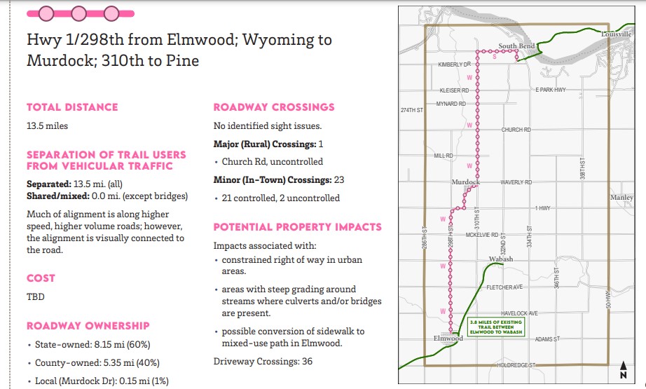
This option takes the trail user close to the highway. It’s the longest route, and it crosses the most driveways. It also excludes the last, and I would say most scenic, miles of trail, including the new trailhead. An advantage is it takes the trail user through Murdock for possible amenities like food, and also lessens the possibility of dust.
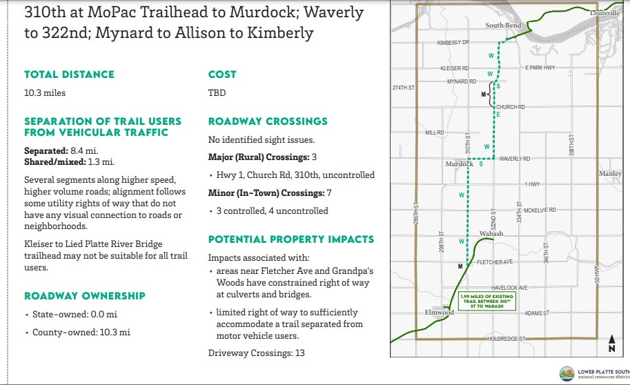
This route also excludes the end of the trail, but less of it. Advantages include passing by Grandpa’s Woods, where one can get food and drink (and maybe a round of golf.) The route also includes Murdock. Some of the route is adjacent to the highway.
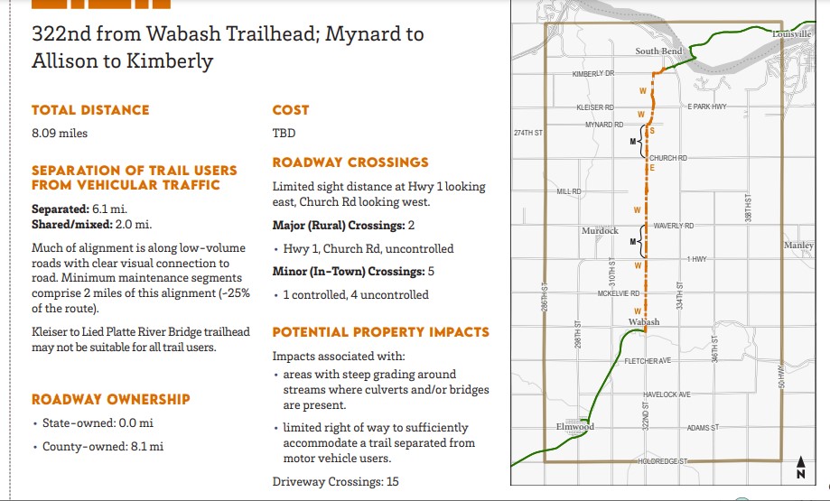
This route from the trailhead in Wabash is the most direct. It would occupy two miles of minimum maintenance road. The biggest challenge may be repairing the existing flood damage from Church road to Mynard. In my view, this is the most interesting part of the route and follows along and crosses under the old Rock Island trestle.
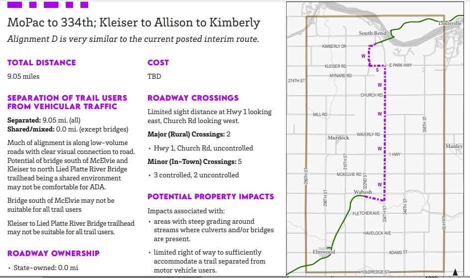
This route is almost the same as the current marked gap route on gravel roads. The difference is the mile of trail continuing east along the NRD-owned MoPac rail corridor that extends from the current trail head, connecting with 334th.
Eventually, we hope to see camping options in the area, like there are along the Chief Standing Bear and Wabash Trace trails.
If you would like to see more of this study, go to https://mopac-east-connector-trail-study-lpsnrd.hub.arcgis.com/