So let’s say you’ve explored Lincoln’s trails and want to get out of the city on a bigger adventure but still be close to home. You have a number of options. How far you ride will be determined by your time allotment and endurance level.

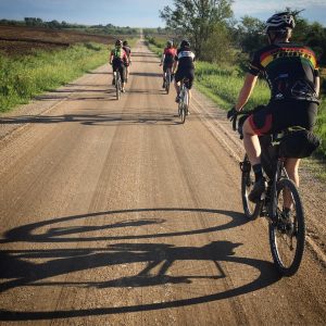
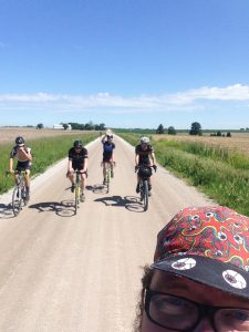
This weekend I wanted to explore the Mopac trail to Omaha a little more in depth. I left early with friends headed for Platte River State Park and their excellent breakfast. At about 40 miles from my house, it’s a good place to refuel. We took the Mopac east for about 20 miles from the 84th St. trailhead, which even with all the recent rain was in good shape since the rains have been hard and haven’t soaked in very much.
Early morning is a great time to be on the trail. The sun is rising, the fog is lifting, the wind is light, and the air is cool. The bridge just after Fletcher crosses the trail near Wabash is still out since the flooding of a year ago, so from there one has to make a choice of how to continue to the Lied Bridge over the Platte near South Bend. I prefer gravel and dirt roads to anything else if conditions are good, but I know many riders would prefer to take highway shoulders.

The Mopac has been open since the mid-1990’s, but the 10 mile connecting link from Wabash to the Lied bridge has been in limbo until last year. The railway corridor was lost and the land was sold back to area landholders, as was the Rock Island rail corridor to Omaha from Lincoln before it. The current plan, approved by the Dept. of Roads last year, calls for a connection from Elmwood. It will create a trail next to Hwy 1 through Murdock, along County Road 330 to Hwy 66 and then connecting to the Platte River Bridge. Platte River State Park and their breakfast is just three uphill miles east of the bridge. At the Lied Bridge trailhead, one picks up a newer section of the Mopac. Once across the river, the trail parallels Hwy 31 to the vehicular traffic bridge at Louisville, about 4 miles. From there it shoots north along Hwy 50 to Springfield, almost 8 miles. Out of Springfield north you will be on the older Mopac until Schram road, just over 3 miles. You can see the Sapp Brothers truck stop coffeepot water tower about a mile in the distance. The plan is to eventually connect the trail to Chalco Rec Area via Schram Rd and 168th Street and the Omaha Metro Trail System. Currently, you have to take highway shoulders or gravel roads. There are places to get food and water along the way, but you should make sure you are prepared for the distance between them, along with other open road essentials from spare tubes to sunscreen.
I hope you got out and hit the trails this past holiday weekend.
